….it seems like making quick, shareable, easy, dynamic reports from ArcGIS Online data should be a solved problem. Yet, it isn’t. Until now.

PORTLAND, OR – September 22, 2021.
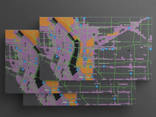
Dymaptic, an Esri Silver Esri Partner Network partner, just announced the official launch of infomaptic – its beautiful new ArcGIS feature reporting app. And infomaptic is not just any old reporting tool. It immediately fills a market need where straightforward and GIS-friendly reporting tools had previously been lacking. Infomaptic integrates fully and seamlessly with ArcGIS Online and Enterprise data and permissions, which means users will be able to create visually pleasing and intuitive feature reports using their own data already in ArcGIS.
Infomaptic is already available on the Esri ArcGIS Marketplace, and early feedback has been quick to recognize its great potential. It’s easy to use both from the field and in the office, it simplifies the previously arduous process of creating feature reports, and the standalone format both saves its users money and fills an immediate need on the market. The early enthusiasm makes perfect sense to Geospatial Services Manager Nathan Smith at the City of Round Rock. In offering “both a seamless and streamlined experience to any ArcGIS user,” Smith says, “infomaptic is a welcome breath of fresh air in the world of geospatial reporting.”
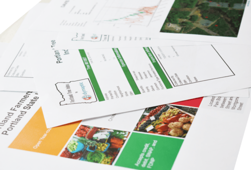
For Christopher Moravec, Dymaptic CTO and Lead Architect of infomaptic, it’s about telling the story of an individual record. “Dashboards help provide context and an overall view,” he says, “but the details are often lost in statistics. We built infomaptic to help tell the story of individual data points. To help share the attributes, attachments, and details of a single record.”
Infomaptic tells this story elegantly and easily. The feature reports are crisp and appealing, customizable, and easy to configure. Furthermore, infomaptic bridges the gap between the field and the office. In addition to making data come alive on screen via the interactive map/platform, infomaptic allows for easy sharing of feature reports via PDF – making it perfect for people without GIS expertise. Scott Allgood, Director – Data Services and GIS at Gulf Energy Information, agrees. “Infomaptic allows us to quickly deliver dynamic reports and PDFs directly to our users,” he says, “ensuring that they have immediate access to the changing data attributes we provide them with.” It’s a huge competitive leg up for his organization.
Infomaptic’s customizable templates populate beautiful, streamlined, and intuitive views and reports. “We are very proud of the app,” Mr. Moravec says, “infomaptic will revolutionize the visualization and presentation of ArcGIS data.”
ArcGIS reporting has never been this quick or this easy.
Dymaptic is a GIS services provider based out of Portland, OR. It has a presence in multiple states and works towards local, regional, national, and international markets. In addition to their established GIS services, the company develops off-the-shelf products and just launched infomaptic, which is available on the Esri ArcGIS Marketplace.
Media contact:

Mara Stoica
CEO
+1-503-470-0515
mara@dymaptic.com
See this Press Release online at these locations as well:
Featured photo by Andrea Piacquadio from Pexels
Related articles

If you’re looking to create a script and schedule it in ArcGIS Online, the ArcGIS API for Python and Notebooks are the way to go. Say a clie...
If you’ve used ArcGIS Online recently, you may have noticed a new option when you’re opening a map: Open in Map Viewer Beta. Esri has been w...